Overview: With a few steps, HelioScope users can determine the height of an object by matching the object’s shadow to the date and time the image was taken. HelioScope displays the shadows for any Keepout object drawn in the software, which can be matched up to the date and time of the satellite image to estimate of the height of the object. The video and steps below describe the process:
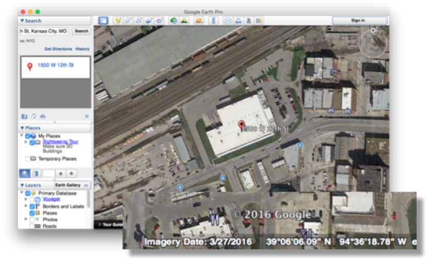
- Determine the date of the satellite image. The default satellite image in HelioScope is the primary image from Google Earth. Open Google Earth for the site and note the “Imagery Date” at the bottom of the page. Nearmap users can find the image date at the top of the Nearmap website.
- Update the “Keepout from shade” date. Go to the Keepout tab and click the “(10:00-2:00)” link next to “Keepout from shade”. Click the calendar icon and set the date that the image was taken. Save to confirm the new shade window.

- Set an initial height of the Keepout: Add a Keepout around the object based on an estimated height. This is will create a reference shade pattern in HelioScope which can be compared to the shadow in the satellite image.
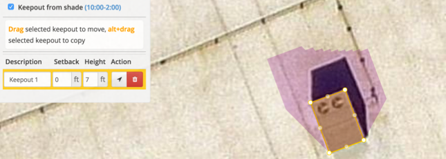
- Determine the time of image capture: For additional precision, reduce the time window under “Keepout from shade” to a specific time (ex. from 12:00-12:00). This will show a single shadow instead of a range of shadows for the Keepout. Adjust the time up or down until the angle of the Keepout’s shadow lines up with the satellite image’s shadow. Note: both the start and end time need to be adjusted
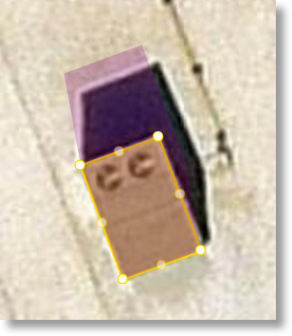
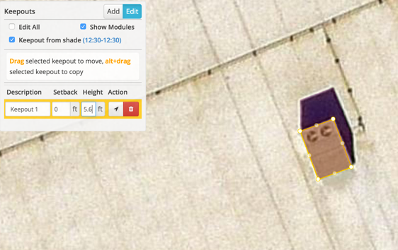
- Adjust the height of the Keepout: Using the shadow from the Keepout as a guide, adjust the height of the Keepout until its shadow lines up with the shadow in the satellite image. The height of the Keepout now accurately reflects the height of the real life object.
A note on modeling trees: if the image was taken during a time when a tree has no leaves, be careful to estimate the additional area the leaves will take up.